
Blue Carbon Restoration In south Clarendon
GOAL:
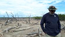
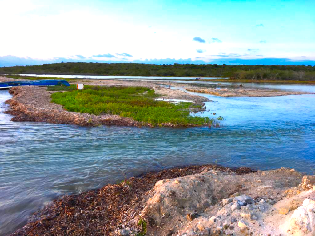
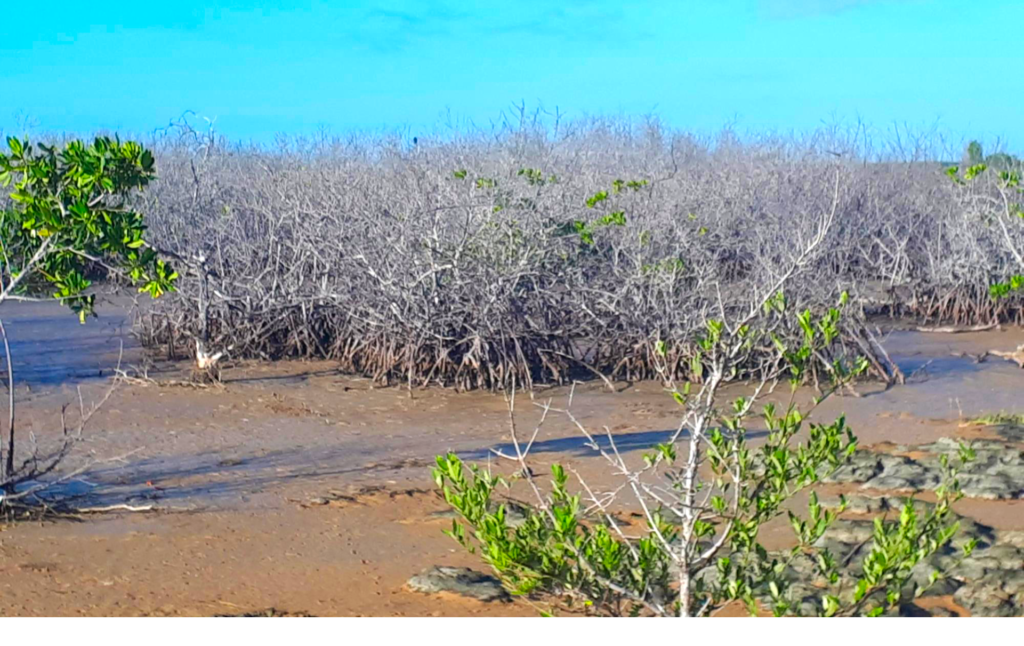
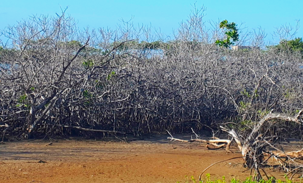
Along the south coast of Jamaica there is about a 40 km long coastline that ought to have healthy mangroves for all the ecosystem services these marine forests provide. However of the >3500 hectares of mangroves along this coast, >1600 are dead and much of the rest is imperiled.
Major contributors to the death of the mangroves include, changes in hydrology arising from coastline alterations after large storms, falloff in agriculture and hence irrigation water flows, human impact through ill-conceived engineering works such as roads and train tracks that bisect mangroves; and last, not least, and an important factor for sustainability of the mangroves after we have rehabilitated them…..felling of mangroves trees to produce charcoal by local communities.
Thus we have launched a project to use site specific diagnostics, to inform restorative interventions.
A grant from the Inter American Development Bank (IDB) has provided support (2020-2026) for UWI SODECO SFS to develop and execute a project to sustainably restore where damaged these large acreages of mangroves in southern Clarendon. UWI SODECO is also collaborating with the private sector to fashion impact bonds to focus on sustaining the mangroves that are currently alive delivering ecosystem services.
THE PROBLEM:
Coastal Mangrove Forest, Transition Zone and Dry Forest: The Mangrove Ecosystem One of a number of marine and terrestrial protected areas in Jamaica is Portland Bight, which includes Portland Ridge, one of the largest pristine dry forests in the western hemisphere, identified to be within one of the Key Biodiversity Areas on the island.
Jamaica’s forests are the main repositories of terrestrial as well as marine biodiversity, especially of endemic flora and fauna. The limestone dry forest transitions into the coastline where mangrove forests constitute another key biodiversity repository as well as playing coastal protection functions.
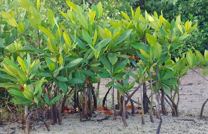
Mangrove forests provide vital ecosystem services including, protection of the Jamaican shore and near shore areas from marine ingress and erosion, biodiversity, nursery functions for marine life, and are critical for mitigation of climate change through carbon sequestration, and their loss yields catastrophic environmental outcomes.
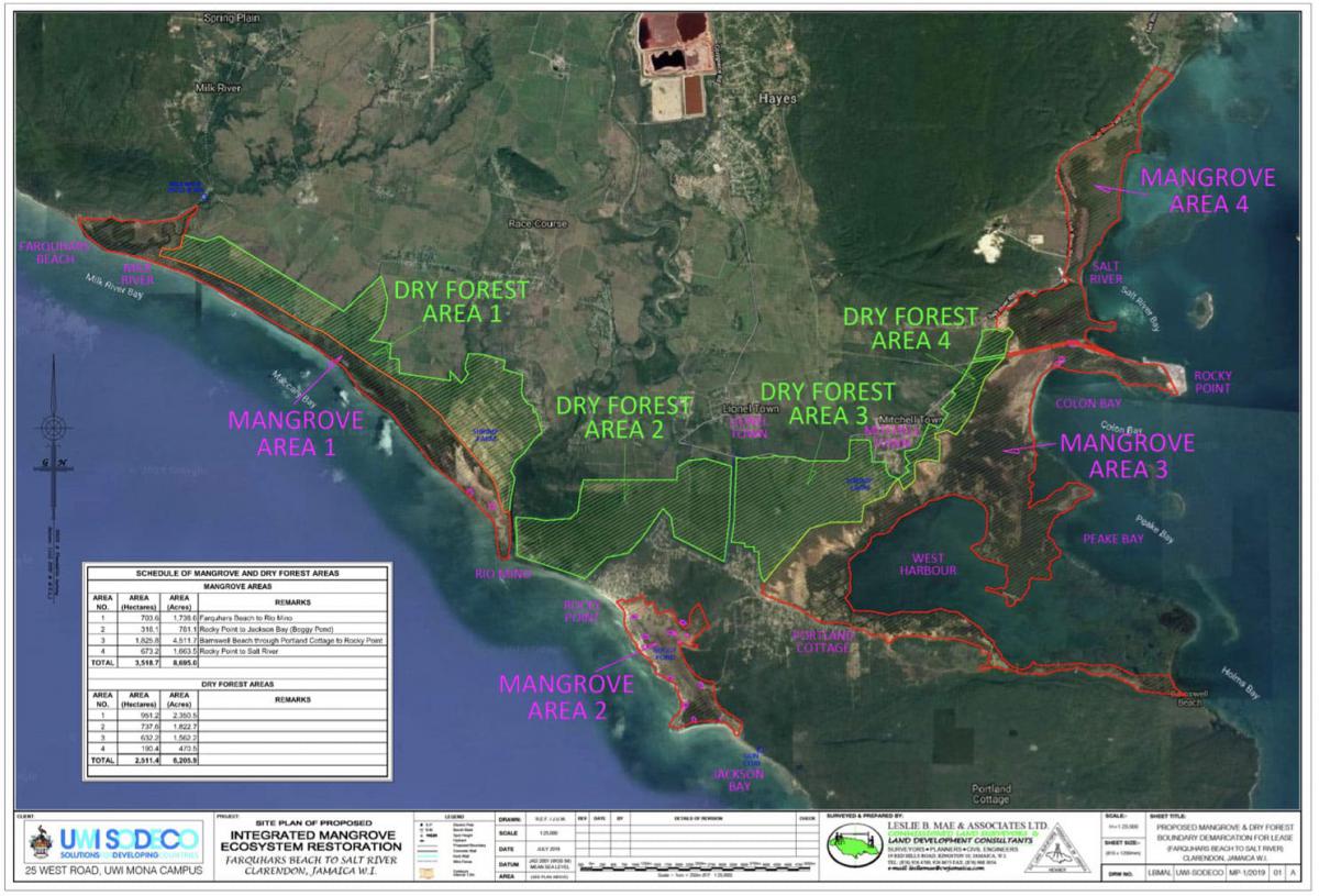
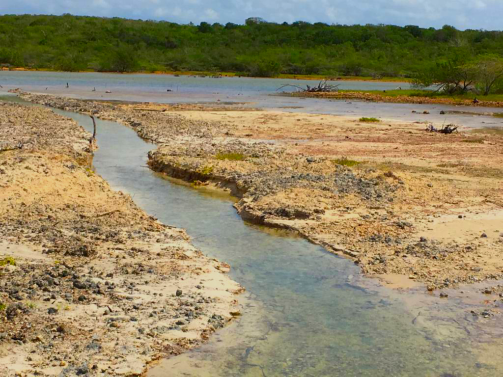
Over the past three decades these coastal mangroves stretching along the Portland Ridge from Jackson Bay westward to Farquhar Beach, Milk River and again eastwards from Mitchell Town through Rocky Point Port and Salt River to Cockpit have seen a dramatic decline in both extent and health (see map).
One key contributor to the mangrove decimation is the reduction in fresh water runoff from declining agricultural activities from sugar cane cultivation and sugar manufacturing with resulting hyper- salinity above the range where mangroves can survive, let alone flourish.
However extreme historical weather events and direct human impact e.g., aquaculture infrastructure, roads and railways have also contributed significantly.
MANGROVE RESTORATION ACTIVITIES
PROJECT: RESTORATION OF THE MANGROVES AND ADJACENT TRANSITIONAL AREAS AND DRY LIMESTONE FORESTS
The UWI SODECO SFS team leads the mangrove restoration programme and includes collaborators, UWI St Augustine Department of Life Sciences, UWI Centre for Marine Sciences, Mona; Institute of Marine Affairs, Trinidad; Scripps Institute of Oceanography, University of San Diego, USA. This grouping has the experience with evidence based implementation and technical depth to design and execute this extensive project. Very important for the success of the project, the SCJH has undertaken to provide some critical resources towards restoration. These include the following.
Long-term land tenure (49 year lease, renewable) of, all those areas with mangroves, healthy as well as destroyed , and those adjacent areas that have the potential to again become mangrove; areas contiguous that will form the transitional zone as well as the continuation into areas that should be replanted or improved as dry forest. The marine and terrestrial dry forest along with the intervening transitional areas function as a single ecosystem and are in fact co-dependent. The renewable, peppercorn 49 year (J$100 per annum) lease has been signed with UWI Solutions for Developing Countries, which is tasked to carry out this project and provides a connected ecosystem of >6,000 hectares. This acreage with associated buildings and other infrastructure has been formally organised into the UWI SODECO Living Lab to support translation research relevant to enhancing resilience in this ecosystem including development of new technologies.
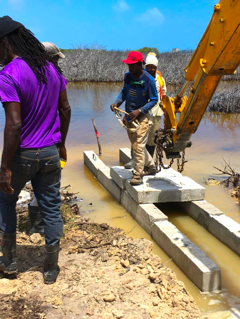
2. Mangroves thrive over a range of salinities ranging between that of sea water and fresh water. Much of the serial loss of significantmarine mangrove forest is related to hypersalinity, and we have tracked the loss of mangrove over the past two plus decades and related it to a shrinking of the cultivation of sugar cane and related factory activities in this southern Clarendon area. Access to water, channelled to the mangroves will be vital to mangrove restoration efforts. SCJH has agreed to make available water from agriculture related activities, weather related run off as well as water from the nearby Salt River using its existing irrigation water distribution infrastructure to enable this.
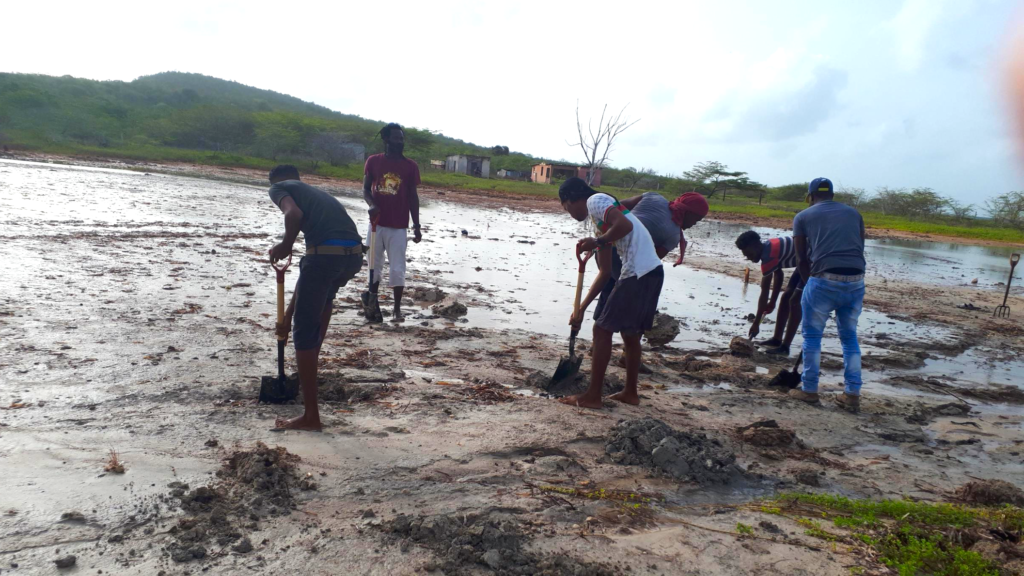
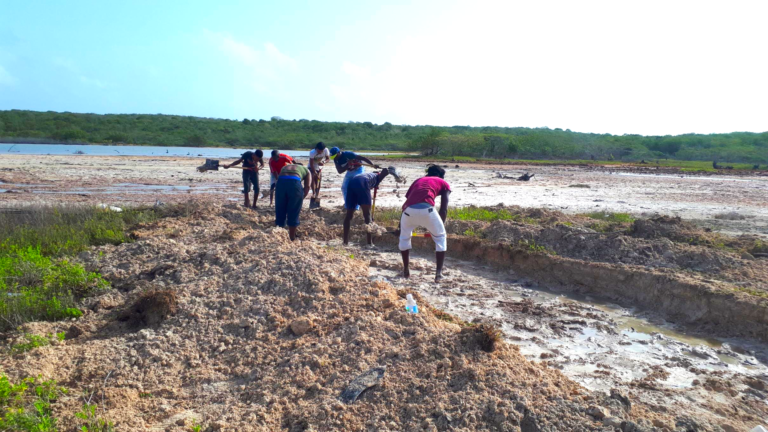
Access to every square foot of all tracts of the mangrove forest is vital to restoration and preservation activities. Thus vehicular access to roads and intervals by UWI SODCEO SFS to carry out examination of the state of the mangroves, restoration of same and preservation activities is also essential. SCJ has made available field guides knowledgeable about the cane interval network on SCJH sugar lands including these near mangroves and adjacent areas. UWI SODECO SFS has engaged experienced land surveyors as stakeholders (Leslie Mae and Associates) who have contributed services as a contribution to the project. Our surveyors are far advanced in performing the required surveys and GIS mapping of all target areas. Mapping includes remote satellite images as well as drone aerial imagery of the marine forests and adjacent transitional and dry forest components of the ecosystem.
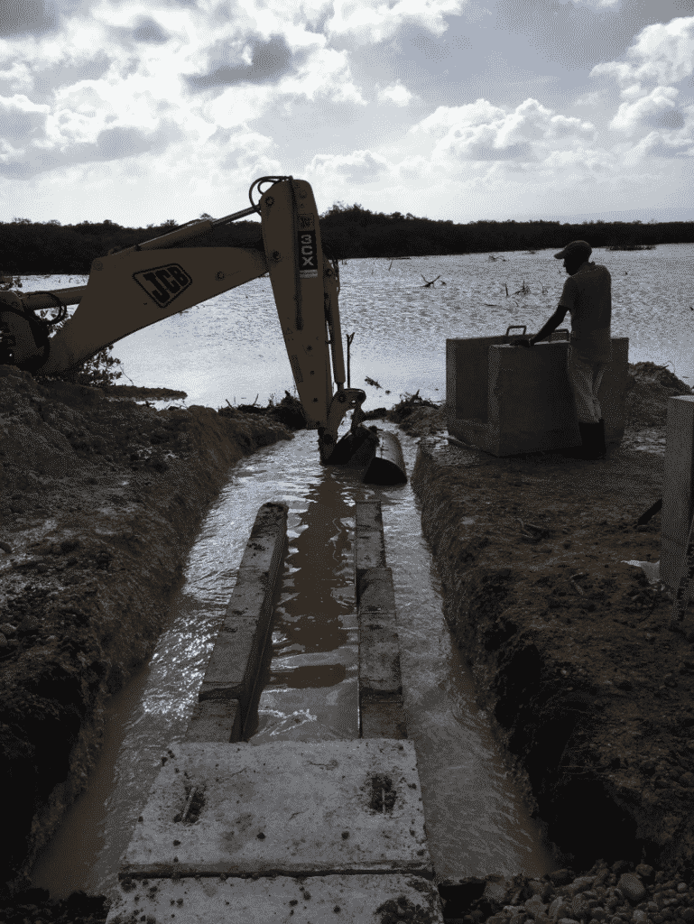
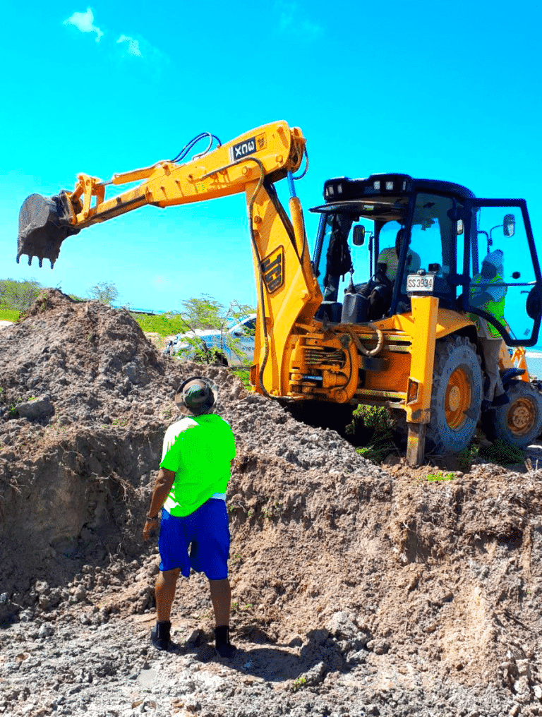
4.Use of heavy earth moving and excavating equipment as well as trucking will be required once UWI SODECO obtains topographic mapping to guide the earthworks for water flows as well as intra mangrove circulation. SCJH has agreed to use its good offices to facilitate access to such equipment that its network holds and operates.
5. Design and execution of this extensive project requires a physical presence in the area of restoration work. To this end SCJH has made available a structurally sound building at Monymusk to house the UWI SODECO Research Centre which will execute this project. This building has been leased also at peppercorn rates of J$100 per annum under the same 49 year renewable conditions. The budgetfor the upkeep and maintenance of the buildings will be covered by grants but ultimately the project itself needs to be financially sustainable and so sources of income are now being developed.
Over the past three decades these coastal mangroves stretching along the Portland Ridge from Jackson Bay westward to Farquhar Beach, Milk River and again eastwards from Mitchell Town through Rocky Point Port and Salt River to Cockpit have seen a dramatic decline in both extent and health (see map). One key contributor to the mangrove decimation is the reduction in fresh water runoff from declining agricultural activities from sugar cane cultivation and sugar manufacturing with resulting hyper-salinity above the range where mangroves can survive, let alone flourish. However extreme historical weather events and direct human impact e.g., aquaculture infrastructure, roads and railways have also contributed significantly.
Project Documents:
")
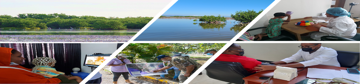
Click image to view Project Gallery

